WEB PAGE OF
C.K.MOHAMED TELLICHERRY

| | WEB PAGE OF C.K.MOHAMED TELLICHERRY |

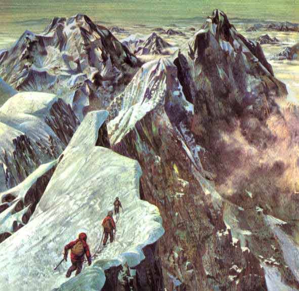
The world's highest mountain, estimated as reaching 29,029 ft (29,002 ft being the mean of six readings computed in 1852).
Situated in the Himalayas on the borders of Nepal and Tibet, Mount Everest is part of the great Tertiary folding of the Earth's crust that gave rise to the
Alps in Europe. Metamorphic and granitic rock have been recognized at its base, giving place
above 23,000 ft to stratified limestones and calcareous-quartz schists. The mountain was named about 1855 after Goeorge Everest of the Geodetic Survey of India.
Its Tibetan name is Chumolungma, "Sacred Mother of the Waters". 
Below: SIR GEORGE EVEREST, for whom the highest mountain in the world EVEREST was named. He was surveyor-general, and applied the triangulation system to the problem of large-scale mapping.
In 1823, the Indian Trigonometrical Survey, as the mapping of the sub-continent was called, gained a new surveyor general - SIR GEORGE EVEREST. He it was who first applied the "gridiron," or triangulation, system to large-scale map-making, and he who accurately established the India arc of the meridian (a line of known coordinates running from the southern tip of India to its northen frontier).
Everest's innovation made it possible to calculate the relationship between any two geographical points in India. There was now a mathematical basis for determining the relative
positions of the great Himalayan peaks, as well as their heights above sea level. To determine the height of an unknown peak, the survryor travelled to an observation post whose height was know. From
there he measured the peak's angle of elevation relative to a horizontal plane. From this he could determine the height of the peak above the observation post, and hence it height above sea level.
Below Today we know that the geography of the earth is the result of continual change and movement over millions of years
of geologic time. The world's mountain ranges are the product of these changes. There are FOUR basic type of mountain. Vocanic mountains
form when lava and ashes burst through the earth's curst. Some still display the cones of extinct or living volcanoes. Dome mountains
form when the top section of the earth's crust rises into domes like huge blisters. Faultblock mountains form when the earth's curst breaks
into great blocks, some of which move upward, while some move downward. Folded mountains form when the earth's crust
wrinkels into wavelike forms. One of the theories put forward to explain this last phenomenon is that,
as the earth's center cools, its surface contracts, causing a wrinkling in the
strata beneath the earth's curst. But whatever the cause, the forces are huge and have pushed
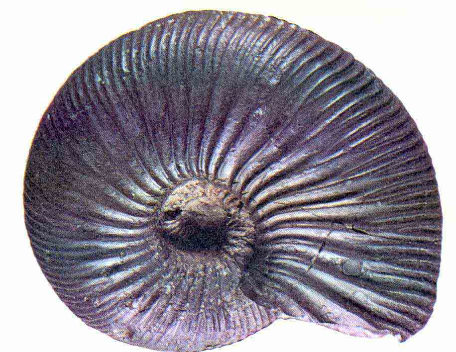
up mountains peaks of tremendous heights. In the Himalaya, fossile forms of marine life can be found at 18,000 feet - indicating that in some remote past this mountain range was once in the floor of a sea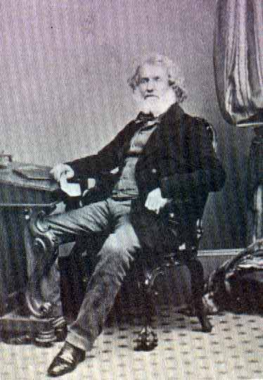
a marine fossil, 130 million years old. It was discovered 18,000 feet up in the Himalayas, showing that this range was once beneath the sea.